Lesvos 2017


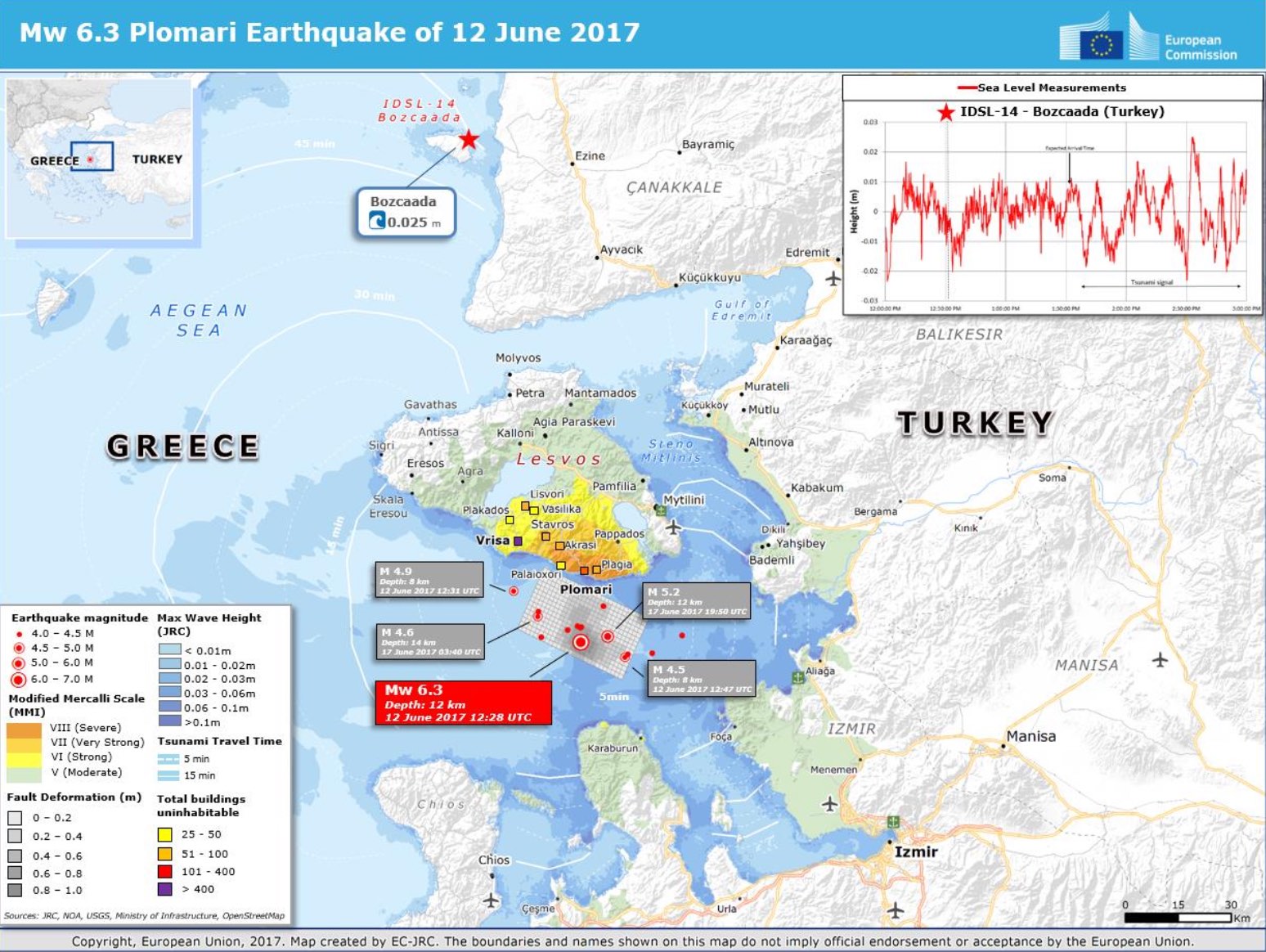
Map created by EC-JRC
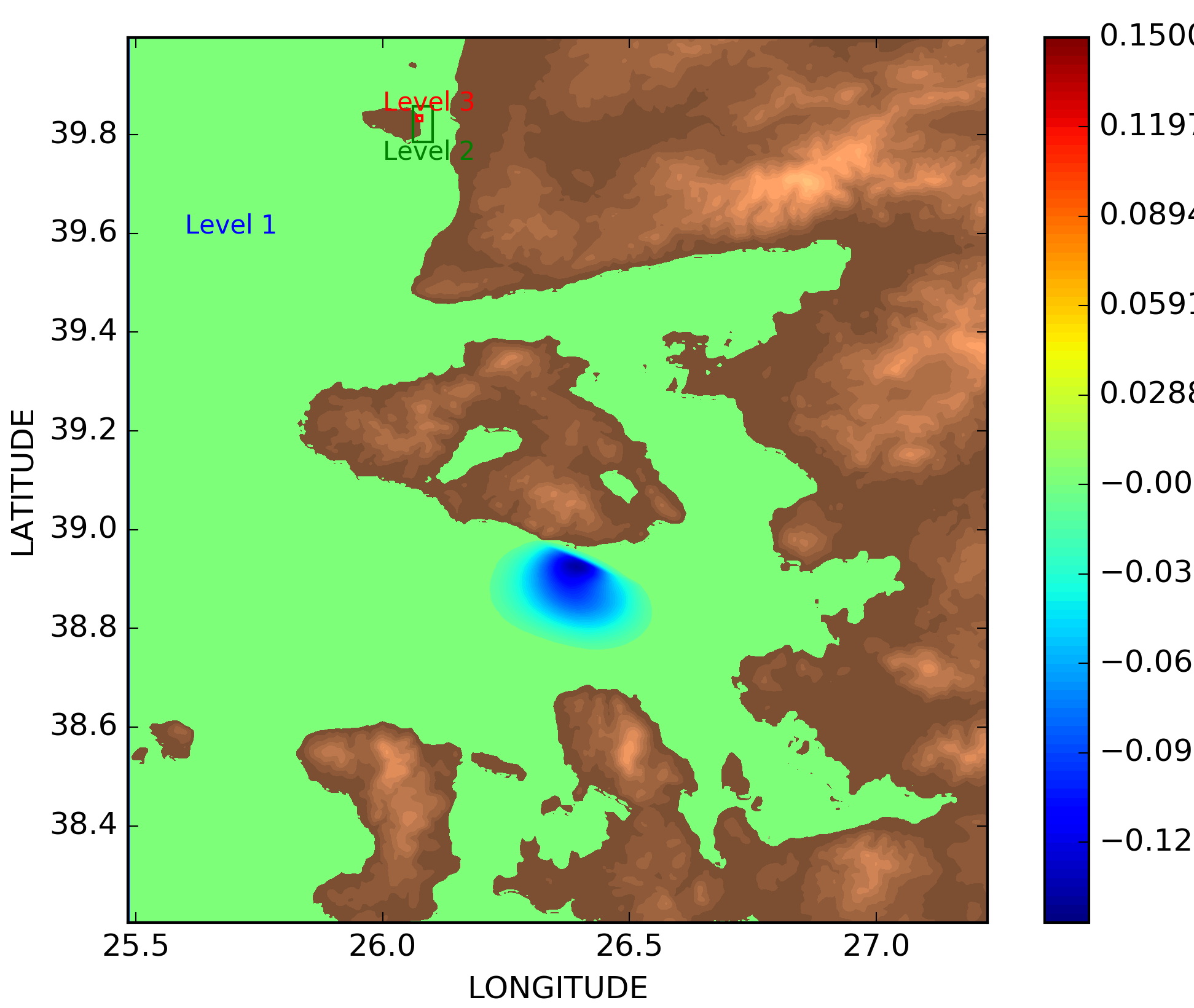
Initial condition and nested meshes of the simulation performed by EDANYA Group


On 12 June 2017 (UTC 12:28:38.26) a magnitude Mw 6.3 earthquake occurred offshore Lesvos Island in SE Aegean Sea, which was widely felt, caused 1 fatality, and partially ruined the village of Vrisa on the south-eastern coast of the island.  The event ruptured a NW-SE trending normal fault and had a focal depth of 13 km.


 Here the available data to compare with (time series at available gauges, runup or water height at given locations, ...)

Lesvos tide gauge locations

  • Wave arrived in Plomari 1.5 min (neg. wave) or 4 min (pos. wave) min; max wave about 40 cm
  • Small wave identified in Bozcaada sea level signal at about 1h

bozcaada obs ts


  • Annunziato et al (2017). "Analysis of the Tsunami Event caused by the Mw 6.3 Lesvos Island (East Aegean Sea) Earthquake of 12th June 2017''.

lesvos new nivel0 max height recbozcaada obs ts